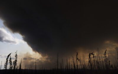
A satellite image taken the morning of Tuesday, Jan. 21, 2025, showing lake effect snow across the Great Lakes. (USA TODAY Network)
NOAA’s Climate Prediction Center is calling for a warmer-than-normal, more mild fall in Michigan, but the return of La Niña could complicate the outlook for winter.
Current forecasts show well-above average temperatures for the state this winter, with equal chances for precipitation — including snow. However, forecasters also expect a transition from standard ocean temperatures to La Niña, with a 71% chance by December, according to the National Oceanic and Atmospheric Administration.
In La Niña years, winters often bring more frequent swings in the jet stream, opening the door for bursts of colder air and stormier periods that might not be reflected in the broad seasonal outlook.
How does La Niña influence Michigan winters?
La Niña tends to shift the jet stream northward. For the Great Lakes region, that historically means colder-than-average temperatures and above-average snowfall. It also increases the likelihood of polar air intrusions — when the polar vortex, a ring of strong winds that normally keeps Arctic air bottled up near the North Pole, weakens or wobbles, allowing frigid air to spill south into the United States, often bringing freezing temperatures and significant snowfall.
In Michigan, La Niña winters are often marked by stronger westerly to northwesterly winds crossing the Great Lakes, which can fuel heavy lake-effect snow, according to the National Oceanic and Atmospheric Administration. This is especially common along the Lake Michigan and Lake Superior snowbelts, impacting cities such as Muskegon, Traverse City and Marquette. If the lakes remain ice-free later into the season, as anticipated due to the warmer-than-normal temperatures, snow events can be more frequent and more intense.
For example, during past La Niña years, parts of western and northern Michigan have seen multiple lake-effect snowstorms that dropped several feet of snow in short periods. Southern Michigan may not see the same lake-effect totals but can still experience colder-than-average conditions and occasional heavy snow when storms line up with Arctic outbreaks.
Similarly, across Lake Erie, in November 2022, Buffalo’s record-setting, lake-effect snowstorm occurred during a La Niña winter, fitting this classic pattern: cold northwesterly winds over Lake Erie dumped several feet of snow in just a few days.
What is La Niña?
La Niña — Spanish for “the girl” — happens when the surface waters of the central and eastern Pacific Ocean are colder than normal for several months in a row, according to the National Weather Service. It’s part of a natural climate pattern called the El Niño–Southern Oscillation, which flips back and forth every few years between La Niña (cooler waters) and El Niño (warmer waters).
These shifts in ocean temperatures may seem small, but they can nudge the jet stream and change weather patterns all over the world. While its counter part El Niño — “the boy” — often brings milder winters to the northern US, La Niña tends to set the stage for colder snaps and more volatile conditions there.
When ocean temperatures in the central and eastern Pacific are close to average — not unusually warm like El Niño or unusually cool like La Niña — scientists call it ENSO neutral. Neutral conditions mean the Pacific isn’t giving the atmosphere a strong push one way or the other, so seasonal weather patterns are more likely to be shaped by other factors, like the Arctic or Atlantic oceans.
What is lake-effect snow?
Lake-effect snow occurs when cold, dry Arctic air moves over a large, relatively warm lake, creating narrow bands of clouds. This phenomenon can produce snowfall that lasts anywhere from a few minutes to several days.
Wind direction is also crucial in determining which areas will receive lake-effect snow. Heavy snowfall may occur in one location while the sun shines just a mile or two away in either direction.
Brandi D. Addison covers weather across the United States as the Weather Connect Reporter for the USA TODAY Network. She can be reached at [email protected].
This article originally appeared on Lansing State Journal: La Niña is coming, experts warn. Is lake-effect snow in Michigan’s forecast this winter?
Reporting by Brandi D. Addison, USA TODAY NETWORK / Lansing State Journal
USA TODAY Network via Reuters Connect
Author

OPINION: Ending the EPA’s Endangerment Finding would kill pollution protections
President Donald Trump and Lee Zeldin are taking steps to roll back the EPA’s Endangerment Finding, which is essential for protecting us against...

To get that perfect ear of corn, weather has to cooperate. But climate change is making it dicier
PAW PAW (AP)—Robb Rynd and his brother grew up farming and wanted to do more of it outside their day jobs, so they went in together on what's now a...

Empowering environmental stewardship: barn sanctuary champions compassion and conservation
By Donté Smith, Capital News Service LANSING — The Great Lakes, a vital freshwater expanse for millions, face an ongoing environmental crisis....
Can Michigan’s forests survive climate change? One researcher is finding out
By Emilio Perez Ibarguen, Capital News Service LANSING – As Michigan’s climate warms, tree species like red pine and eastern white pine may no...
Years after high water crisis, lax policies leave Michigan coast vulnerable
By Emilio Perez Ibarguen, Capital News Service LANSING – Kathy and Tom Brickley knew erosion would be an immutable part of owning a property on Lake...