
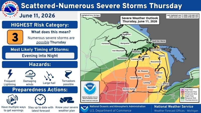
Another line of severe thunderstorms is forecast to rumble through Michigan on Thursday, June 11, and could be worse than what we’ve seen the previous two days.
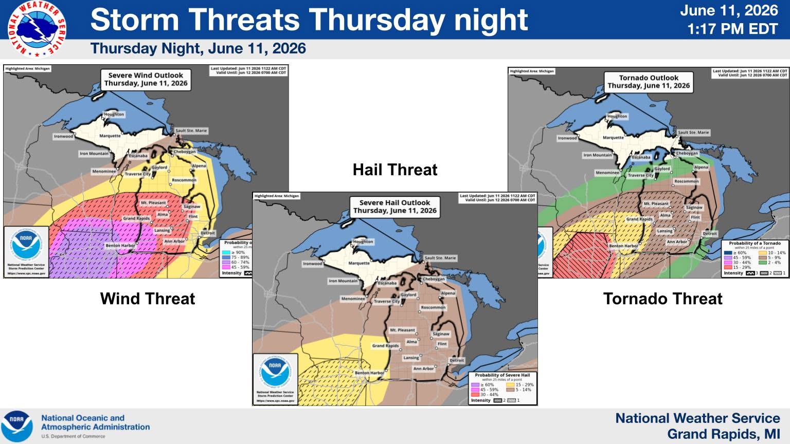
The National Weather Service says Michigan residents should prepare for fierce winds up to 75 mph, isolated tornadoes, 1-inch hail, lightning and localized flash flooding when storms arrive Thursday night.
Southern Michigan is again under a heat advisory from noon until 8 p.m. as the heat index could reach near 100 degrees.
Thunderstorms on Wednesday, June 10, brought winds of more than 60 mph and heavy rain. Power outages included 84,477 customers as of 7:30 a.m. on Thursday, June 11, according to Poweroutage.us.
Here’s a breakdown of Thursday’s storms, according to the National Weather Service:
When will thunderstorms arrive on Thursday, June 11?
Storms are expected to sweep west to east Thursday afternoon during the overnight hours, June 11. Across the northern L.P., storms are forecast to arrive around 5 p.m. and last until 3 a.m.
West Michigan, including Lansing and Grand Rapids, is expected to see thunderstorms move in around 5 p.m. and last until 3 a.m., according to the NWS hourly forecast. Rain may develop earlier in the afternoon.
In the southeast Lower Peninsula, storms will arrive as early as 8 p.m. and last until 3 a.m. The most likely storm-window is from 10 p.m. to 2 a.m., according to the NWS Detroit office.
“A Slight to Enhanced Risk remains in place for tonight. All modes of severe weather, including heavy rain, will be possible if line holds together. Have multiple ways to receive warnings, especially those that will wake you up overnight,” the NWS Detroit office said on X on June 11.
“Strong/severe thunderstorms are expected in Michigan late this afternoon into tonight (June 11),” the Gaylord NWS posted on social media on June 11. “Severe storms are most likely in northern lower MI, especially south of M-32.”
The entire Lower Peninsula is under risk to see damaging conditions that could include 75 mph wind gusts, isolated tornadoes, 1-inch hail, lightning and localized flash flooding.
Reporting by Sarah Moore, USA TODAY NETWORK / Lansing State Journal
USA TODAY Network via Reuters Connect